
| Home | Contact Infomation |
|---|
As mentioned above the purpose of these web pages to provide quick access to trail information for the serious hiker. While some rudimentary explanatory text and statistics is included in the web pages the intent is to provide most of the information in the form of maps. In part this dependence on maps is a reflection of the philosophy that hiking should be an exploration of your environment and if too much text description is given then the opportunity for personal exploration/surprises is greatly reduced. The reader is invited to experiment both approaches and draw their own conclusions. The Mt. Rainier web pages provide the most text and graphic information. In contrast the Leavenworth web pages (which will be added soon) provide minimal text description. Try them both and let me know what you think about the different approaches:
Early on several different types of maps were experimented with (see the experimental map section below). The Mt. Rainier web pages illustrate many of these early experiments. However, most users seemed to most appreciate simply enhancing USGS topographic maps to emphasize trails. These enchantments are described below.
USGS Topographic Map Enhancements
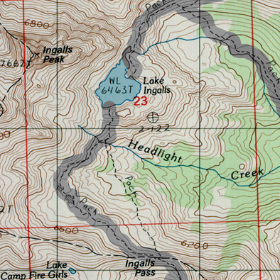 |
The simplest enhancement was to highlight trail information. To reflect changes in trail information since the USGS map was originally published the highlights some times diverge for the trail locations shown on the USGS maps |
|---|
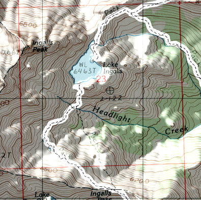 |
The next level of enhancement added shading to the USGS map |
|---|
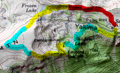 |
The next level of enhancement involves superimposing trail mileage on the map. This mileage is a type of ‘floating scale’ where the color changes every mile (starting with red). This is different from the normal scale in that it includes elevation changes and reflects trail complexity directly. For example, a trail mile with lots of vertical gain and small switchbacks can be significantly shorter on the map then a ‘classical’ map scale that ignores elevation changes and can not resolve the small switchbacks. While I personally found this type of ‘floating scale’ very useful many users did not. So unless I hear differently I will discontinue this enhancement (i.e. only the Ocean beaches and Mt. Rainier Park will have maps consistently enhanced in this way) |
|---|
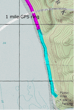 |
The last possible enhancement is to add GPS rings. These are created by drawing circles, centered at the start of the trail, at one mile intervals. By comparing the ‘crow fly’ distance taken from a GPS from the waypoint set at the start of the trial the hiker can easily locate himself by the intersection of corresponding GPS ring distance and the trail. For the mathematically inclined this can be considered very analogous to polar coordinates. Hikers have found this use of local ‘polar coordinates’ to be much faster than reading the traditional longitude and latitude from the edge of the map. |
|---|
Experimental Maps
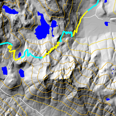 |
Pure Shaded Relief Maps:Gray shaded relief maps are generated by creating shadows with a high resolution Digital Elevation Model (DEM). Basically the computer uses the topographic described by the DEM to calculate shadows, given the suns position, for every hill in the map. Context is this case also includes information about roads(shown in red),countor lines, trails and general relief that that user can utilize in planning his trip |
|---|
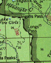 |
US Forest Servide Maps:These maps (both with and without shading) provide place names and road locations. However, the lack the detail and accuracy many hikers require and are being replaced with enhanced USGS topographic maps |
|---|
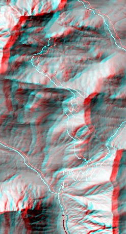 |
Stereo Maps:Using high resolution DEM stereo maps were generated for many trails. Using special glasses (I can send you a pair if you Email me) the user can use these stereo maps to directly see the topographic relief of the basin in 3D. It is designed to mimic what a person would see from an airplane. |
|---|
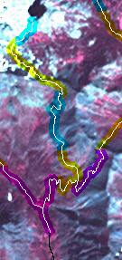 |
Landsat Image Maps:The satellite images map the uses a 1999 Landsat 7 infrared satellite image to give the hiker an understanding of the vegetation he will encounter. In this September 1999 image, vegetation is proportional to the amount of red on the map. Forests tend to be dark red and mountaintops white |
|---|
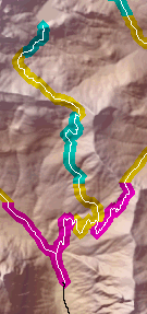 |
Colored Elevation Maps With Shaded Relief:These maps are a blend of colored elevation maps and shaded relief maps. |
|---|
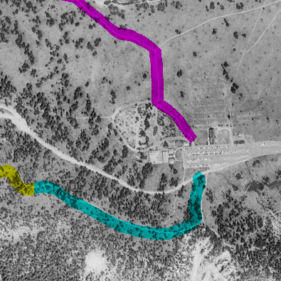 |
Aerial photographsWith tail mileage superimposed these images/maps can be especially useful for backpack trip planning. However, perhaps because of long download times, these maps have not proved to be popular and are they now only offered on the Mt. Rainier web pages |
|---|